C-WAYS source matching work
Contents
Big picture Introduction -- an analogy
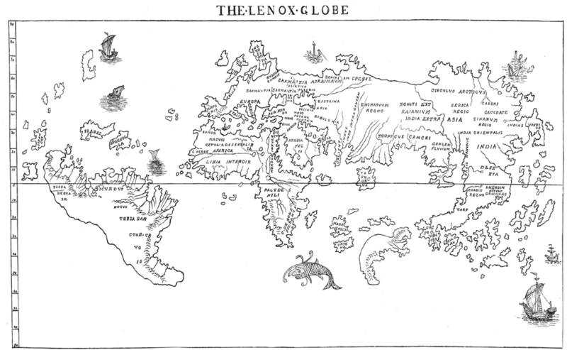
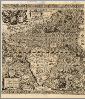
When westerners first discovered the Americas, they were coming at it from the perspective of someone in a boat, with minimal information about what the landforms really looked like. The first thing that they were able to attempt to map was the coasts, because that's what they had the most information about.
Introduction
Several people have done prior studies in BRC 27, BRC 34, and BRC 38 before. You worked hard to find all of these articles in the context of the proposal. Now we actually have to do the work of figuring out which sources are which in all the papers - are the sources called out in paper 1 the same or different sources as paper 2, etc., until all the papers are exhausted, and we have a complete catalog of all the previously studied sources in the region.
The thing that makes this complicated is that, even though everyone is reporting in RA and Dec, not everyone is using exactly the same system (some are 1950 coordinates and some are 2000 coordinate), and not everyone has the same coordinate accuracies (some are working off of photographic plates, and some are working off large-format CCDs). This is where it gets tricky, and where you have to apply your brain! Spitzer, WISE, and 2MASS are all using exactly the same, high-accuracy coordinate system. We need to update the old coordinates by comparing what the old papers say to the 2mass data, as well as fold in the objects with newer coordinates into our collection of sources.
Last year, I thought this would be a relatively simple project that could be done before the summer visit. However, it turned out not to be the case. Part of this is, I think, the complexity of the region (which is the same as last year), and part of it was I think my ability to explain it! I've pulled out and updated all of my best(?) explanations and descriptions here. IF IT DOESN'T MAKE SENSE, PLEASE ASK QUESTIONS. If this is done wrong, or only halfway done, it will make for a LOT of pain downstream.
An analogy
Review the differences between the 1950 and 2000 coordinate systems. REMINDER: THE STARS ARE NOT MOVING. The coordinate system is moving, not the stars. (Well, the stars may really be moving, but we don't have that information, and the size of any such motion will be on the order of a tenth of an arcsec or less; the change due to coordinates is much greater.) An analogy can provide an example. Through Google Maps, I can see that there is a Baskin Robbins near Ms. Linahan's school (from the NITARP 2011 class). I can give you the position of that Baskin Robbins in any of a number of ways:
- 346 North Lake St, Mundelein, IL
- 8 long blocks roughly west of the school
- 4 minutes west of the school (if you drive)
- 20 minutes west of the school (if you walk)
- latitude 42.269711, longitude -88.004308
Or, I could be really pathological and/or vague and say:
- the 3rd oldest Baskin Robbins in Mundelein (NB: i'm just making this up)
- the 5th oldest ice cream store in Munelein (NB: i'm just making this up)
- An ice cream store on Lake, south of Loch Lomond
Are the coordinates different in these systems? Yes, but they are pointing to the same physical location. Is the Baskin Robbins really moving? No.
That is what is going on in these BRCs. The most obvious difference is between B1950 coordinates and the J2000 coordinates -- these are different coordinate systems, and we are trying to translate one into the other, but we are also trying to understand the intrinsic errors of the earlier studies, and figure out which object they were 'really' talking about. In our example above, we want to translate each of the bullets in the above into "latitude 42.269711, longitude -88.004308". The added complication (in the BRCs and in the list above) is that some of the previous authors were not working in particularly precise coordinate systems. Given the list above, your steps in finding the 'true location' of this store would be slightly different for each bullet, and in the end, might include identifing all the ice cream stores on Lake, south of Loch Lomond, figuring out how old the ice cream stores are in Mundelein, figure out how far you could get in radius in a 4min drive from the school, figure out how far you could get in radius in a 20 min walk from school, etc. In this case, you know that all of these pointers are trying to indicate the same physical location, so you could then look at the commonalities in all of those results, and then, eventually, assert with confidence that all of them point to lat/long (42.269711, -88.004308). In the case of the BRCs, we don't know for sure that each object in each paper actually does have a match. Sometimes they don't. Sometimes there really are two objects close to each other, not just one.
So all of this is what we have to do with the BRCs. We have lots of lists of objects, all in slightly different systems and coming from different ways of searching for young stars. We have to apply our brain and figure out which objects each paper is talking about -- which ones are new objects and which ones are the same as objects previously identified.
Long background information
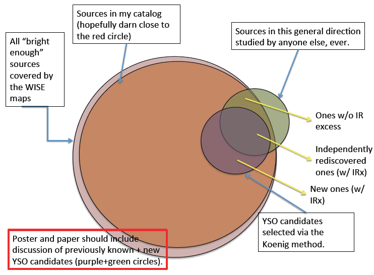
One of the difficulties we will have during this project is keeping all the source lists straight. It happens every year, and I don't know how to make it easier, except for warning you that it will happen! Here is a Venn diagram explaining, roughly, the various source lists we will have, at minimum.
- All "bright enough" sources covered by the Spitzer maps (a conceptual list only)
- Sources in our catalog of extractions (this will end up being mostly a WISE-based catalog, but it will also include some sources from Spitzer in the places where we have that data)
- Sources in this general direction studied by anyone else, ever (the majority of those reported are also YSOs, but not all of them)
Out of those sets, our scientific goals mean that we are aiming for a discussion of:
- YSO candidates we select from IR excess
- YSOs that others identify that do not appear to have an IR excess.
The Venn diagram is even trying to correctly represent the relative sizes of the circles in that "all bright enough sources" ought to be darn close to "sources in the catalog" and that there will be some "sources in this general direction..." not covered by the maps and some of those without IR excesses.
NOW we are going to work on the list of "Sources in this general direction studied by anyone else, ever".
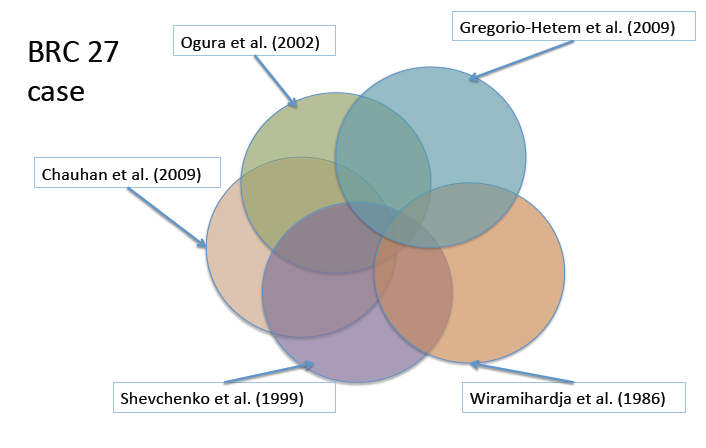
For this diagram, I tried to spatially represent the concepts behind what we're doing now, but I admit the circles are not as carefully constructed/laid out as the first one!
Each of these 5 papers (Ogura et al 2002, Gregorio Hetem et al. 2009, Chauhan et al 2009, Shevchenko et al 1999 and Wiramihardja et al 1986) looked in the direction of BRC27. Surely, then, they saw some of the same sources as each other, and as what we are seeing. For example, the Gregorio-Hetem survey covered a HUGE area, and we care only about a part of it. Ogura saw some of the same sources that Gregorio-Hetem did, but not all of them -- they were not covering the same areas, but even within the same area, they did not see the same sources, because one survey was X-ray driven, and one was Halpha driven. They *will* see different sources, not only because they're looking at different wavelengths, but also because each survey is not infinitely deep -- the sensitivity of the surveys is limited, and as such will not see every source in this direction. Same for each other pair of papers, and our survey.
The goal here is to construct a list that is as clean as possible for each of the objects that these other folks studied, identifying which objects are truly the same between surveys, and identifying which of these objects are ones that those authors thought were actually young stars (as opposed to, e.g., background giants). We also want to carry along each of the relevant bits of information that these other authors provided -- the object is a lot easier to identify as clearly a young object or a contaminant if there is optical data, so if the other authors reported any optical measurements, we should keep track of those and tie them to the correct object in our analysis. We should also make note of any spectral types or other relevant information. The aim of this part of the project is thus:
- Which objects from paper x are also seen in paper y?
and then, the next step we will take is
- Which of these objects are seen in the WISE and/or Spitzer data?
This would be an easy task if:
- everyone provided their original images, either as a figure or as a fits file
- everyone worked in the same coordinate system, by which i mean not just "J2000" vs "B1950" but "J2000 tied to 2MASS" as opposed to "J2000 tied to the pulsars seen by NRAO" or "J2000 as calibrated as best I can based on the HST Guide Stars I happen to see in my image".
- the objects were all greater than 5 arcseconds apart from each other on the sky, such that each source that is detected was cleanly and uniquely detected in each survey.
- and, of course, if we were guaranteed a match between surveys.
Working backwards up that list...
We've already talked above about how we are not guaranteed a match between surveys, because stars are different brightnesses at different bands, and because the surveys have limited sensitivity.
There are plenty of sources that are very close together. Even among just the YSO candidates, some are very close to each other, closer than 5 arcseconds.
If we had fabulous coordinates for everything, we could let the computer match them all up and not worry about it. But we don't. And it's not just a matter of precessing the B1950 ones to J2000 ones either - there are inherent errors in those old coordinates which will not necessarily smoothly map into a clean match to other objects.
If we had images, we could line them up by eye and identify the same objects in each frame. I don't necessarily mean "line them up in ds9" (which would be the ideal case). But also, you can identify the objects simply by comparison between images they publish and images to which you have access (IRAC, 2MASS, POSS). This is what we are going to have to retreat to, in the tough cases.
Here are some notes on these 5 papers, in no particular order:
- Gregorio-Hetem - finding charts for a few complex fields, which may or may not be in our region. J2000 coordinates tied to 2mass, though, so less worried about these. note that their discussion includes this very conceptual problem -- they are trying to tie X-ray sources to optical sources.
- Wiramihardja - no finding charts; a few very coarse-scale ones, one with just YSOs. Not a lot of help here. Also just 1950 coordinates read off a photographic plate. Likely to be large and unsystematic errors.
- Shevchenko - finding chart provided (fig 1). 1950 coordinates. big field (bigger than the region we care about).
- Ogura - finding chart provided; J2000 coordinates but not necessarily tied to 2MASS.
- Chauhan - no real finding charts provided; there are a few coarse-scale ones. J2000 coordinates tied to 2mass, though, so less worried about these.
For each of these 5 papers, we need a machine-readable (read as "plain text file that the computer can parse into individual numbers rather than images of numbers") version of the relevant data tables. This was either:
- obtained from the journal itself, in which case the data table is much longer than we need
- obtained by typing in the coordinates of the objects in our fields from these older papers and try to get updated coordinates.
Here is a video I made for last year's team on getting updated coordinates. This approach SHOULD work in MOST cases but did not work in every case; more on this momentarily. What we need to do is :
- type the 1950 coordinates into the 2mass point source archive, making sure that it knows that it is 1950 coordinates; or type in the 2000 coordinates (and it will assume that they are 2000 coordinates).
- look at what comes back, and take the closest *bright* object.
Then we will have 5 lists of UPDATED, HIGH QUALITY coordinates, one per paper, and we can let the computer run through the list, finding the matches between papers. We then can generate one file that purports to have one line per literature object, with all the relevant data on that line. The difficulty comes in that inevitably, a few sources during this process end up tied to the same object, or identified in other ways as duplicates or incorrect matches.
The approach above to get updated coordinates for targets works ON THE ASSUMPTION THAT THERE ARE NOT "TOO MANY" SOURCES NEARBY, AND THAT THE PRIOR SURVEYS, BEING SHALLOW, ARE MOST LIKELY TO MATCH TO THE BRIGHT 2MASS SOURCE. As I say, this should work in MOST cases but not ALL of them.
If the original authors are reporting more than one source within one paper, we should not consolidate them into one unless we are REALLY sure that the original authors were wrong. (This does happen; see my North American Nebula paper for examples.) Within each paper, this is what I would do:
- Go do the 2MASS archive search (Go here: http://irsa.ipac.caltech.edu/applications/Gator/ -- pick 2MASS then on the next page pick 2mass point source catalog (PSC), then use that search page, making sure to specify which coordinate system in which you are working. Use the coordinates from the original paper to avoid transcription errors, as opposed to any subsequent notes or xls files. Be VERY careful to copy the coordinates exactly; that's the most common problem.)
- Look at the sources returned. Is there just one within 5-10 arcsec? that's probably your match; go on to the next source. If there is more than one, is there just one BRIGHT one within 5-10 arcsec? Is there another source from that same paper within 5-10 arcsec? If the answer to either of those questions is yes, go on to the next step.
- Go get the images in another window. Compare the images (if provided) from the original papers. We can use Finder Chart (http://irsa.ipac.caltech.edu/applications/FinderChart/) to get DSS and 2MASS images of the region where there is a confusing match. Compare this to the images provided in the papers. Identify which object is the one(s) in the paper.
- With that information, then go back to your PSC, and then use the 2MASS point source catalog to find the actual high-precision coordinates of that specific dot you have identified in the images as the match to the literature object.
Then we can take the updated high-precision lists of coordinates, merge them together, and come up with a new-and-improved list of all the previously identified objects in this region, one line per object with all the relevant information.
Then ultimately we will compare this list to our WISE+Spitzer catalog. There will be some with IR excesses, and some without IR excesses.


